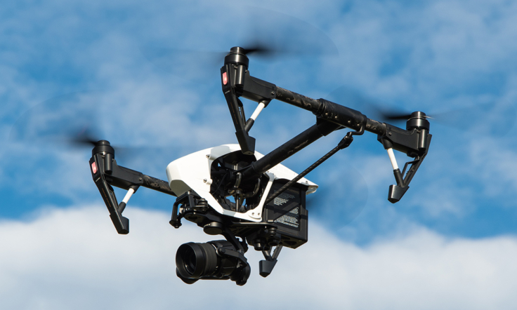
Unmanned air vehicles that controlled by radio signals or can navigate autonomously is called drone. Drone is officially identified as unmanned air vehicles.
Unmanned air vehicles are firstly used in 19th century at wars. Present, it is used in commercial, scientific, entertainment, agricultural and similar applications.
Unmanned air vehicles divided into two as fixed wing and rotary wing.
Fixed wing drones can be described as a small copy of an aircraft. The range of a fixed wing drones is longer than the rotary wing drones. The only disadvantage of fixed wing drone is to need a runway while landing and take-off. Most of the drones used for military purposes are fixed wing.
Rotary wing drones are look like helicopters and has same operating principles. Rotary wing drones divided into two according to engine and number of blades as single rotary and multi rotary (op to 8). Increasing the number of engines allow us to fly more stable and increase the capacity of carrying heavy weight. The most popular multi rotary application is 4 engines platform known as quadcopter. Rotary wing drones does not need a long runway. They can land and take off in a small area. Drones used for civil purposes are generally multi rotary.
Radio frequency (RF) is used to established data connection between drone and control center (remote controller). The data contains many parameters such as altitude, location, distance to target, remaining flight time, load info and wind speed. The images obtained from the camera on aircraft transmitted to pilot and ground control team with data connection.
Drones equipped with a high resolution camera can take stunning aerial photos and videos.
Drones can enter the places safely that a human can not enter. They can be used in search and rescue and security operations.
Drones can check systems such as energy lines, wind turbine and pipelines.
Drones are used by security forces to monitor large areas for surveillance.
Scientists and researchers used drones to observe the different events in nature and watch a certain area.
Drones equipped with three-dimensional cameras and laser scanners can create high-quality three-dimensional maps to be used for surveying, mapping, and precision farming applications.
There are also some applications where drones are used for fast delivery of light packages by air.
Drones continue to develop, and their usage areas are increasing with the technological advancements.


